Whitehaven Beach Map
© Official Whitsundays Website
Google Interactive Map
Satellite Views
Walking Trail Maps
Public Boat Moorings Map
Below you can find the best Whitehaven Beach Map for viewing this stunning location. From Google interactive map to Sattelite views on Whitehaven Beach and the Whitsunday Islands.
Satellite View Of Whitehaven Beach
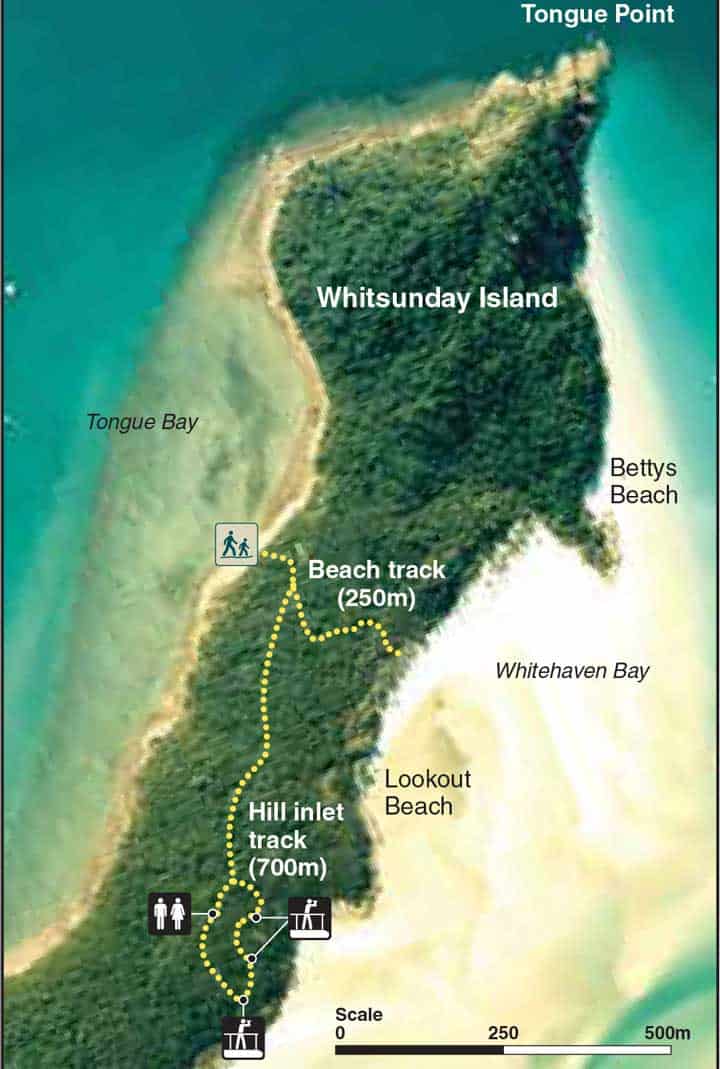
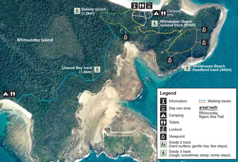
Hill Inlet Lookout And South Whitehaven Lookout Walking Track Map
The below 2 maps of the walking trails at Hill Inlet and South Whitehaven Lookout are from the Queensland National Park website.
You can download and view the full PDF document here


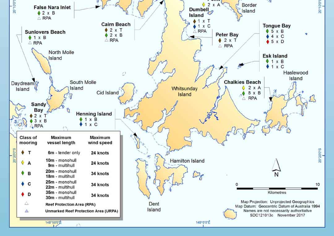
Public Boat Moorings Map Close To Whitehaven Beach

Hi, I’m Nath J, a long-time local who’s been lucky enough to live and work tourism in the Whitsundays since 2001.
Over the past two decades, I’ve helped visitors discover the best of this incredible region, from Whitehaven Beach and Hill Inlet to the hidden spots only locals know about. I started out managing boats and tours, and these days I run Ripple Effect Online, a tourism-focused digital marketing business helping local operators grow and connect with travellers like you.
I’ve written an ebook called Whitsunday Islands: A Journey through Paradise, created countless local travel guides, and earned recognition as a “Whitsundays Tourism Hero” from QTIC for my contribution to the region and gained First Nations Cultural Protocol training through QTIC as well. But more importantly, I’ve spent years listening to travellers, understanding what makes a trip unforgettable, and helping people plan the kind of experience they’ll talk about for years.
If you’re planning a visit to Whitehaven Beach or anywhere in the Whitsundays, I’m here to help you make it amazing.
Find me on Facebook and LinkedIn or drop me an email at info@nath-j.au.
